
Hiking Cone's Dike Trail at Payne's Prairie State Preserve
Location and Hiking Trail Maps with Nature Viewing Information and Photos
Cone’s Dike Trail
Alachua County
Micanopy, Florida
Entry Fee: $6 Per Vehicle
Traffic: Light to Moderate
Official Page at Florida State Parks

PDF Trail Map ^
Interactive Trail Map at AllTrails >
Hiking Basics at Cone’s Dike Trail
Cone’s Dike Trail at Payne’s Prairie State Preserve in Micanopy, Florida offers a 5.3+ mile there-and-back nature walk. And this trail truly puts you face-to-face with nature! Note: For additional trails and information about this location, visit this site at Payne’s Prairie State Preserve.
The hike is easy and mostly flat apart from a short, winding portion at the beginning. This short portion takes you down from a rest area to the prairie. After that, the trail is a straight line with just a couple of corners to turn. This section provides easy hiking, with the trail composed of tarmac and hard earth. In fact, the trail itself is nothing spectacular except for the amazing views and wildlife you are likely to experience.
Plants and Animals Galore!

Watch for Gators
On my July trip, I came upon Florida Cracker Horses roaming wild on the trail. I also found a rather irritable alligator. Since it blocked the trail, it’s easy to see why pets are not allowed here. The prairie views are breathtaking with portions of the horizon painted white by multitudes of blooming, American lotus. Frequently, the wet marshland comes right to the trail on either side. This could make for a short walk as the trail becomes flooded after rains.
Birding, other animal, and flora opportunities abound including a greater variety of wildflowers than I have seen nearly anywhere.
How Far Can You Hike Cone’s Dike Trail?

Pelican
Spring 2023 Update: Nature seems to be reclaiming this narrow trail. Even after a long dry spell of over a month, the marsh has closed in. The trail seems permanently flood at about one and three-quarters miles. Even if you wear high boots or waders, the mud becomes extremely thick. The hiker may go off trail as an alternative into the marsh itself. Given the likelihood of alligators and water moccasins, I highly recommend not doing this.
The good news that a hiker taking the trail as a four mile or less there-and-back may still find great gratification. You may spot alligators, pelicans, sandhill cranes, wood storks, various heron and egrets as well as Florida Cracker Horses. And with so many trails nearby, Cone’s Dike Trail makes for a perfectly fulfilling side-excursion during your day at Payne’s Prairie.
Trail Images Below
![]()
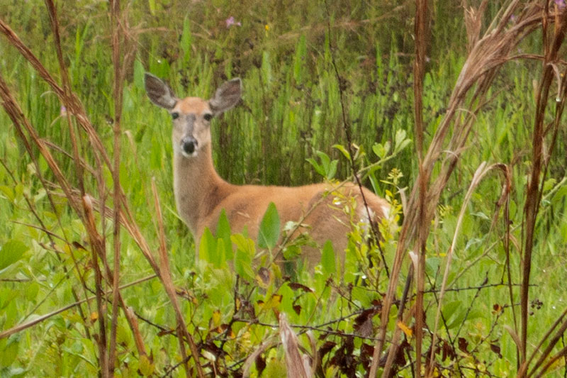
Sure to spot deer

Meadow Vole
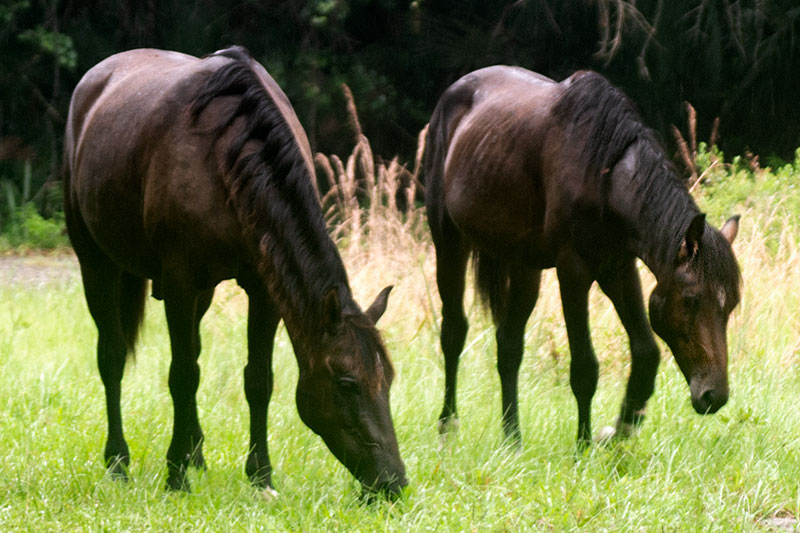
Roaming Florida Cracker Horses
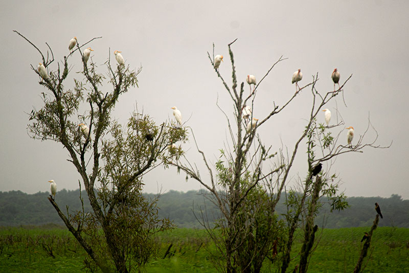
Egrets, Ibis, Blackbirds
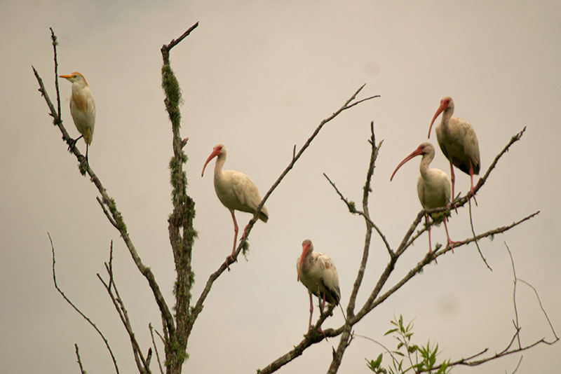
Ibis with Cattle Egret

Red Winged Blackbird

Blue Dasher Dragonfly
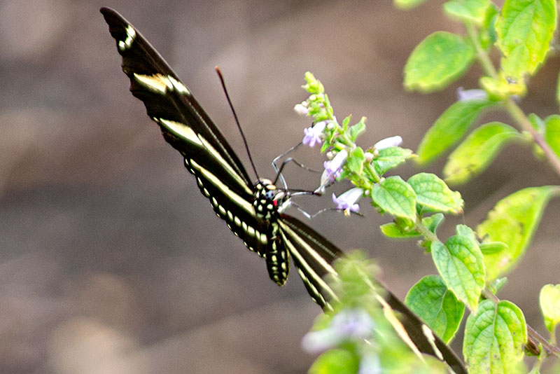
Zebra Longwing Butterfly
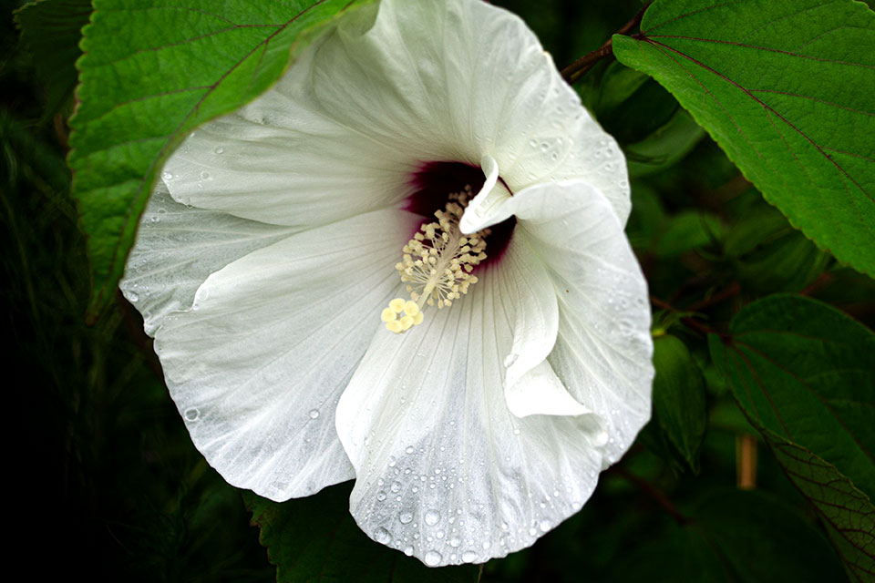
Neches River Rosemallow
![]()