Dunn's Creek State Park Piney Bluff Trails
Location and Hiking Trail Maps with Nature Viewing Information and Photos
Putnam County
Near Pomona Park, Florida
Entry Fee: $5 per vehicle
Traffic: Light
Friends of Dunns Creek State Park Official Website
Dunns Creek Events
The 6300-acre park offers many fun events including camping, kayaking, cookouts, guided hikes, fishing, and much more! The best way to stay up-to-date is by following the Friends of Dunns Creek Park Facebook Page.
Dunn’s Creek State Park- Main Entrance
Note: Find nearby Dunn’s Creek Blue Pond Hiking Loop information on a separate page.
It’s rare to find a greater gem than Dunn’s Creek State Park in Pomona Park in Putnam County, Florida.
 You’ll enjoy miles of hiking, mountain biking, equestrian, picnic, and even kayaking opportunities with great views of Dunn’s Creek, longleaf pine forests, plus birding and other wildlife sightings.
To get on your way, enter at 320 Sisco Road in Pomona (Google Map below) and follow the paved road to the end. It may take close to a mile and you’ll find a paved parking lot. There are basic restroom facilities without running water that are wheelchair accessible.
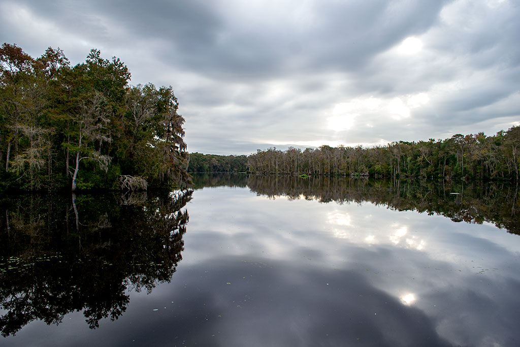
Picnic tables with a nearby grill await with a nice view of Dunn’s Creek, itself as wide as a river. In fact, there is a pier to use whether for bird watching or to launch your kayak.
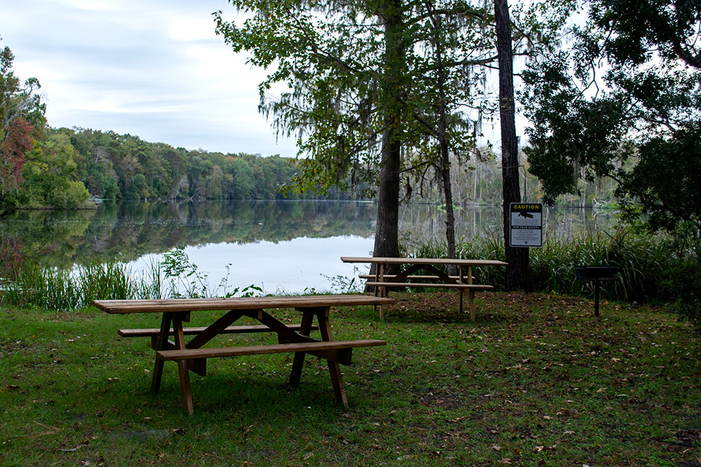
Picnic Area
An adjacent ground has an additional seven or so picnic tables and two more grills, so bring the family for a nice day of cooking with plenty of room for the kids to run and play games. In this adjacent ground you’ll also find the clearly marked trailhead.
Along my way, I also had the good fortune to meet state park employee Ranger Derek.
He loves the park and all that it has to offer, including fun events for campers, hikers, and horseback riders. Be sure to follow the Friends of Dunn’s Creek State Park Facebook Page to keep up with the latest fun and educational events!
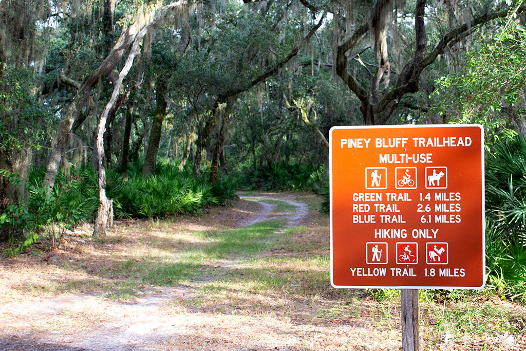
Piney Bluff Trails – Green, Red, and Yellow Blaze Loops

PDF Trail Map
Green, Red, and Yellow Trails ^
Interactive Trail Map at AllTrails >
All four portions of Piney Bluffs Trails (Blue, Green, Red and Yellow blaze) begin from this single trailhead and branch out with various intersections to create your own there-and-backs or loops for as little as 2 miles or as much as 14 or more.
Trailhead
I first hiked red, yellow, and green for about 8 miles total. Yellow is for hiking only, and all others are for biking, hiking, and equestrian. Blue adds about 6 or 7 more miles, and most trails are well-blazed with the blue trail still being developed as of November 2019.
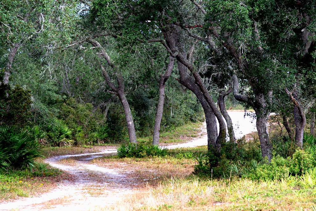
Opened in spring of that same year, the trails provide solitude but little shade.
Rather than musky, canopied forest, you’ll find great, open views of longleaf pine with deer and plenty of birding opportunities.
The trails are well-mowed, with grass mostly under and inch but providing root structure to keep the ground firm. Very little sweet sand will impair your way, so the hard trails are ideal for biking or running.
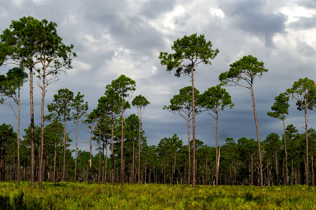
Longleaf Pine

Longleaf Pine

Yellow Trail Live Oak
Piney Bluff Trails – Blue Blaze Loop
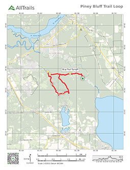
PDF Trail Map
Blue Loop – Horse or Hiking Trail ^
Interactive Trail Map at AllTrails >

Horse and Hiking Trail
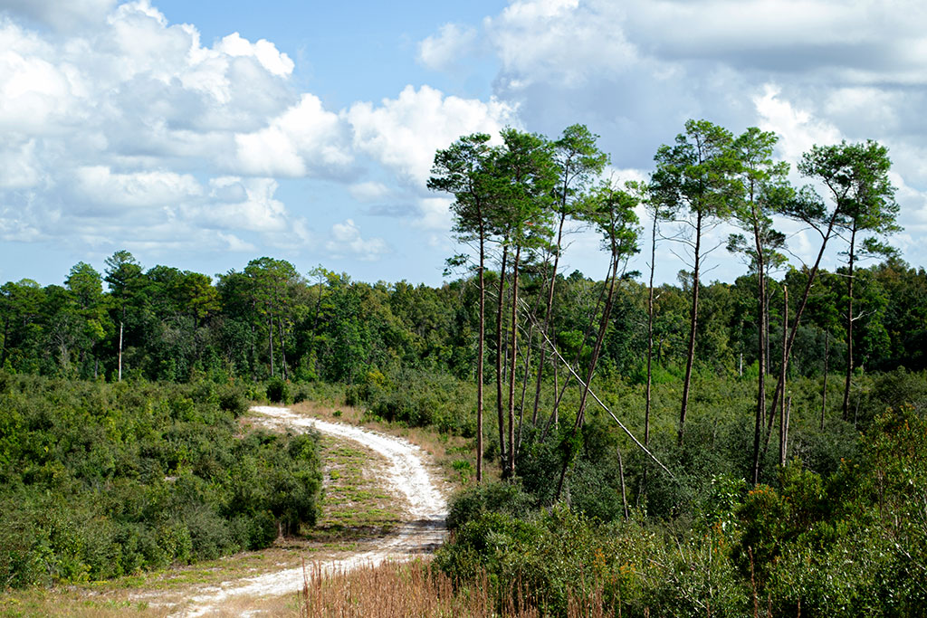
Where Dunn’s Creek State Park truly shines is with the blue blaze trail. It starts at the same trailhead as the green, red, and yellow trails. After a little more than a mile in, you will veer left following my the marker for an amazing loop with great sand hill and prairie views.
You will find many intersecting trails to shorten the 6+ mile length of the loop in half or even less. I strongly suggest taking the full loop as mapped I mapped in PDF and on AllTrails (above) as some of the best, prairie and sand hill views come in later portions of the hike.
Note that while the loop is just over six miles, the overall trail will take you over 9 miles given the trail distance to and from the blue trail start and end point.
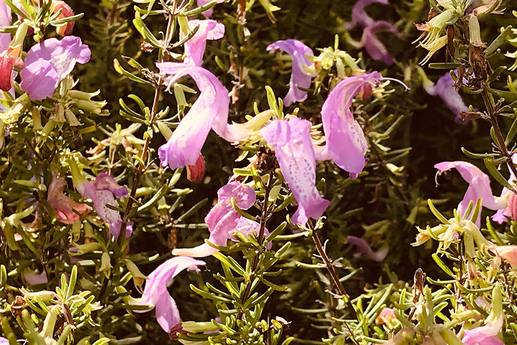
Etoniah Rosemary
I spotted deer, wildflowers including Etoniah rosemary in bloom in early November, and paw prints most likely belong to coyote. With plenty of wild turkey around, you might additionally spot a bobcat.

Soft sand on trail
The trail is primarily designed for horseback riding, which can only add to the splendor of the views given that additional height. Also, most of the trail is in the open, so the sun can be harsh in hotter months.
Although mountain biking is certainly permitted, I recommend sticking to the other trails as the blue trail is fairly hilly and the sand much less compressed.
Enjoy your visit to Dunn’s Creek State Park!
Winding Trail
Shady Relief

Sand Hills
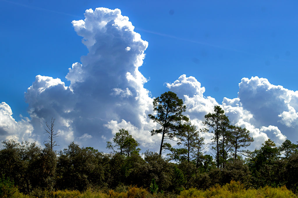
Thunderhead
![]()