Hiking Gore's Landing Unit Wildlife Management Area
Hiking Gore’s Landing Unit WMA to the Ocklawaha River with Trail Map and Images
Gore’s Landing Unit WMA
Marion County
Fort McCoy, Florida
Entry Fee: None
Traffic: Light
Florida Fish and Wildlife Conservation Commission Official Page

PDF Trail Map ^
Interactive Trail Map at AllTrails >
Which Park is Gore’s Landing Unit WMA? Avoid Confusion…
You might confuse Gores Landing Unit WMA with the park just a quarter mile up the road from it, Gores Landing. Gores Landing, the park, offers fishing, picnic area, and amenities for only $5 per car with an additional $5 for overnight camping.
Gore’s Landing Unit Wildlife Management Area discussed here is purely for fishing, hunting, and of course hiking, equestrian, and biking.
Parking and entry are free, and the Google map below will get you there.

Conyer Road
Gores Landing Unit WMA is part of the Cross Florida Greenway (Marjorie Harris Carr Cross Florida Greenway if you want to get fancy, but that is a mouthful!) This portion, the Gores Landing Unit, seems a portion only I have stumbled across to map and is not even listed on the Greenway site.
But it’s wonderful hiking. Just be sure to go during a dry season. The trails to the river can flood easily for months at a time.
These trails through Ocala National Forest consists partially of old roads such as Coyner Road seen on the sign below, but they are now closed to motor traffic. I’m not sure the trails/old roads are maintained, but they are clearer and easier to follow than most you can find and quite wide.
Finding the Ocklawaha River at Gore’s Landing Unit WMA

Great Egret (black legs)
Starting at the main trail head, veer right (east) at the first break you reach in a small clearing, and it will lead you to a very nice spot along the Ocklawaha River. I saw plenty of fish in summer and spring, and the view is beautiful with bird sightings including great egret (distinguishable from great heron by its darker legs) and white ibis on my most recent visit. There and back will take you just under 3 miles, and there are other trails to follow.
Up further, again veer right (east) for a second Ocklawaha River view. Once back to parking, these two stops will give you about 5 miles of hiking or riding. The roads lead further and there are surely more trails if you want to extend your visit, but it is easy to spend an hour or two at either of the river views.
Trail Images Below
![]()
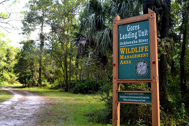
Entrance

Sunrise
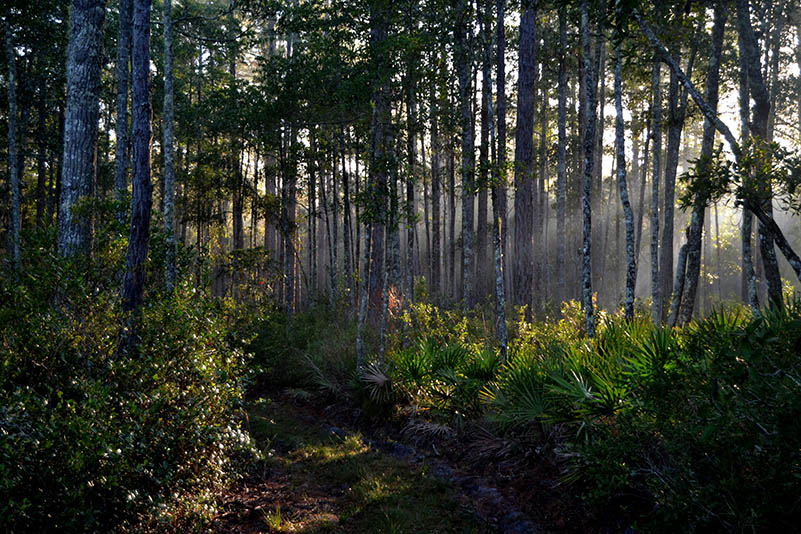
Sunburst

Ocklawaha River

Shoreline
![]()