Upland Trail at Ocklawaha Prairie Restoration Area
Hiking Upland Trail (White Blaze) at Ocklawaha Prairie Restoration Area
Upland Trail at Ocklawaha Prairie Restoration Area
Marion County
Ocala, Florida
Entry Fee: None
Traffic: Light
St. John’s River Water Management District (SJRWMD) Official Page

PDF Trail Map ^
Interactive Trail Map at AllTrails >
Locating Ocklawaha Prairie Restoration Area
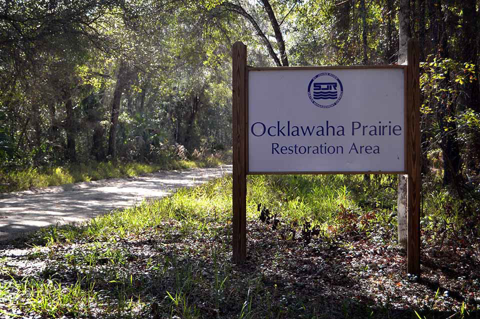
Ocklawaha Prairie Restoration Area
The Ocklawaha Prairie Restoration Area has changed a great deal in the past few years. The Saint Johns River Management District has added a white blaze loop called Upland Trail. And it’s a no miss! For that reason, I have completely updated this page as of May 21, 2021 to reflect this fun little 4.4 mile loop.
You will find an ample parking area on SE 137th Ave Road in Marion County. I have a Google Map below to help. But while it’s easy to find, I suggest driving slowly on that .7 stretch of earthen road. It has potentially damaging cobblestone and major potholes you won’t see coming. 10-15 mph is suggested, and you’ll slow to 5 mph or less at times.
The trail biking is also very good, with woods and small hills leading to Old Celery Farm Road, the bulk of Levee Trail. This trail road offers hard earth, no motor vehicle access, and great views of the Ocklawaha prairie. No doubt, the Saint Johns River Management District is doing good work here, restoring wetlands to a previous state.
Hiking the White Blaze Loop
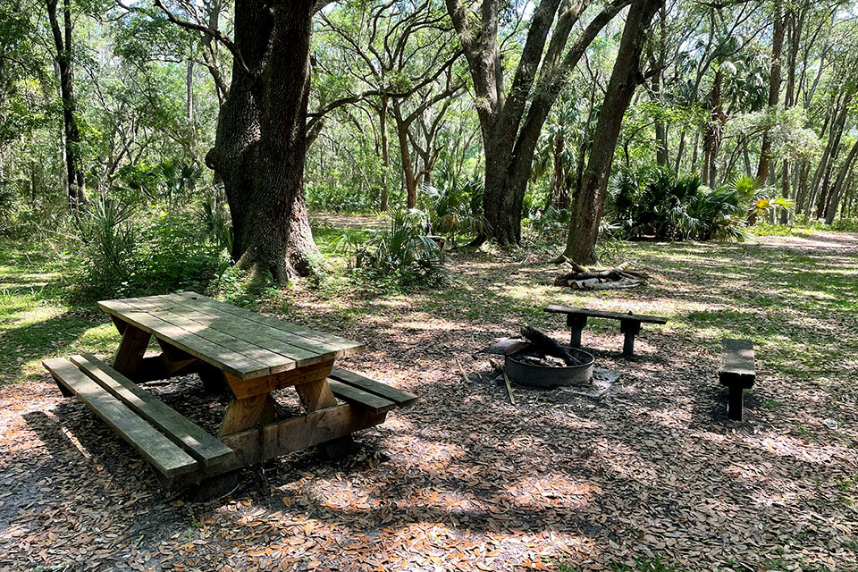
Picnic and Camping
At 4.4 miles and plenty to stop and see, the white blaze loop offers a fun couple of hours. There’s a rustic camping area near the Ocklawaha River, too. You can pitch a tent there and spend the night. It offers a picnic table and a fire pit plus river access. At about about midway through the hike and near the Ocklawaha River, it makes a nice stop for a rest and a snack.
About a quarter to a third of the trail is heavily wooded. The rest winds through open fields of pine with plenty of sun exposure. So you might consider hiking in cooler months or in the morning. That said, the trail thus far is very well-maintained and quite wide. At no point did I wade through grass and worry about chiggers. Otherwise, wildlife is abundant. On a casual visit, I identified many wildflowers along with deer, pileated woodpeckers, and other birds.
Horseback riders will plenty of space to park a trailer and a separate trail for riding.
Also, be sure to visit Chernobyl Memorial Forest Loop nearby, and also part of the Ocklawaha Preservation system.
Trail Images Below
![]()

Ample Parking

Clean, Wide Trails
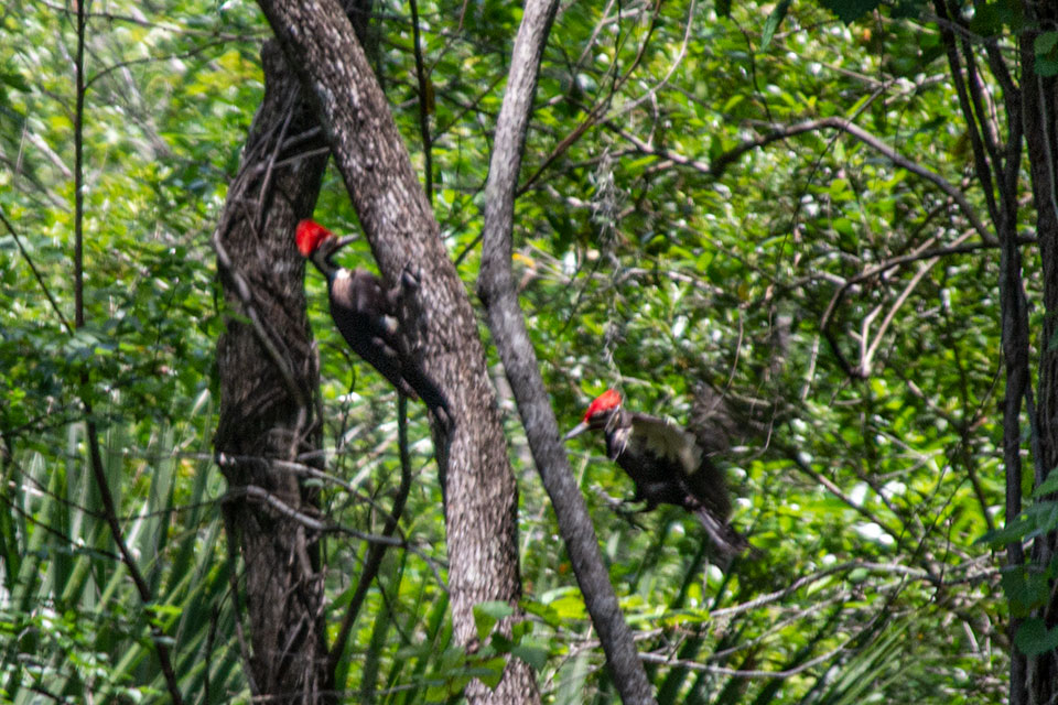
Pileated Woodpeckers

Open Prairie
![]()