LEAFS Stewardship Forest Hiking Trail
Hiking the Stewardship Forest of LEAFS: Longleaf Ecology and Forestry Society
Alachua County
Waldo, Florida
Entry Fee: None
Traffic: Light to None
Longleaf Ecology and Forestry Society (LEAFS) Official Website

PDF Trail Map ^
Interactive Trail Map at AllTrails >
LEAFS Trail Location and Basics
Hiking LEAFS Trail provides ample hiking through a longleaf pine forest. The Longleaf Ecology and Forestry Society (LEAFS) preserves this land for native plant and animal life. But for hikers, it’s an opportunity get out there and enjoy the trails!

Entrance
Note that there is no noticeable parking area. If you follow the map, simply park off-road by the sign. And do not turn down the neighboring road as it is private and full of angry dogs.
While the map at the entrance makes it look as though the trail is one simple loop, there are actually a maze of intersecting trails with no markings. You may find yourself wandering, and I recommend using my map below linked to AllTrails. This way, you can keep you on course even as you explore.
What are the Trails Like?
Also, as of October 2019, the trails are greatly overgrown with tall grass, some of it thick and reaching 5 feet high. That said, the trails are still easy to follow. You will just find yourself wading through weeds on the way, so I recommend long pants and spraying for ticks as the season dictates. For a more often used, better maintained trail, head just a half mile or so up the road to LEAFS at Lake Alto Park. You’ll find Treefrog Trail there as well, which leads into the Lake Alto Preserve trails.

Trailhead
The trails are still quite enjoyable. Just take precautions and enjoy your short hike through this splendid pine forest. Along with longleafs, you will find plenty of shrubs such as inkberry and winterberry plus opportunities for bird watching. You might even see a flying squirrel!
The guide says the hike is a half-mile loop, but there are many other trails and cross trails. With some markers being down (or hidden) you can easily spend 2-3 miles in here, and even much more if you plan to hike all the trails.
Find below pictures and a Google Map.
Trail Images Below
![]()

Palmetto and Pine
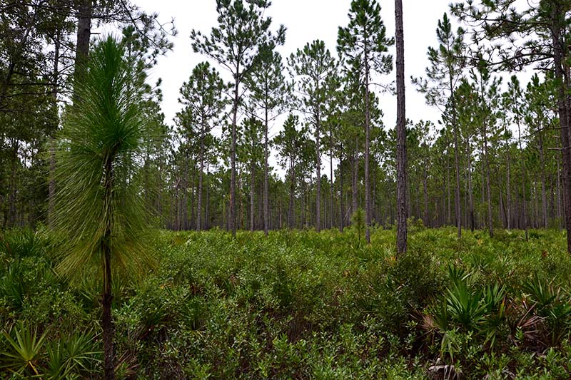
Longleaf Pine
![]()