Hiking Pruitt Trail
Location and Hiking Trail Maps with Nature Viewing Information and Photos
Hiking Pruitt Trail
Marion County
Southwest of Ocala, Florida
Entry Fee: None
Hiking, biking, equestrian / horseback
Traffic: Light

PDF Trail Map ^
Interactive Trail Map at AllTrails >
Important Overview

Entrance to the multi-use trail
The Pruitt Trailhead at Ross Prairie begins as a multi-use trail. You can use it for walking, backpacking, mountain biking, and horseback riding. But you will also find splits to separate, parallel trails for hiking or equestrian only. As such, I recommend reviewing the maps provided above. They provide information where to find the hiking trails, which are more interesting than the multi-use trail. In that way, you can choose to combine them to create one or more loops. Or you may simply choose to use the hiking portions for some, most, or nearly all of your walk.
And since the hiking portions consist of a Florida Trail segment, you can hike or backpack as far as you want. I have mapped it as a 7-mile there-and-back trail. Most hikers will use it as a 6-mile there-and back, but I circled around to include splits listed as waypoints.
Reaching the Pruitt Trail at Ross Prairie
The Pruitt Trailhead lies about half an hour southwest of Ocala and near Marion County Airport. I’ve provided a Google Map below. It’s really a nice countryside drive. You’ll see farmland views and find very little traffic.
Yet, be cautious as you pull in. The dirt drive is a couple tenths of a mile long. After a few initial potholes, you may be tempted to speed up a little. Keep your speed down – more potholes likely await. And some of them appear in unavoidable clusters. You won’t have a problem as long as you keep your speed down. After that, you’ll find picnic tables, a porta-potty, and ample parking including for horse trailers.
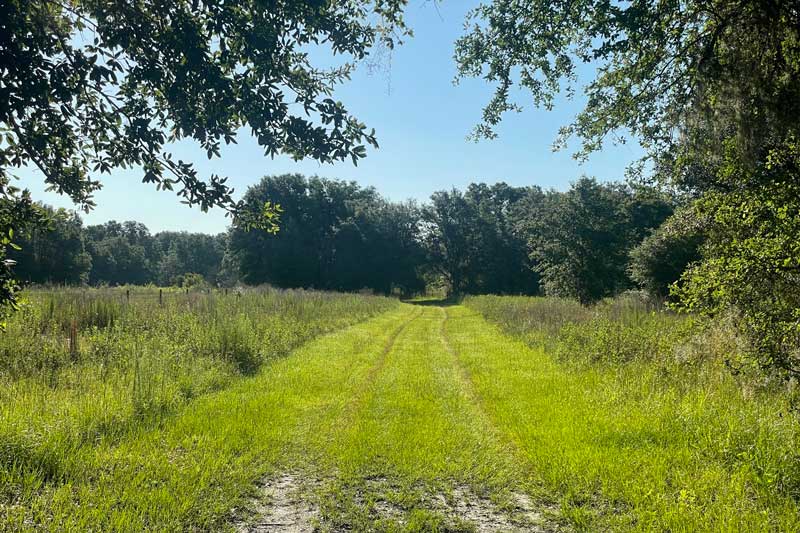
Multi-Use Portion of Pruitt Trail
Hiking Pruitt Trail
This trail begins as a wide, multi-use trail with little shade but really nice pastoral views. It’s a super-pleasant country walk for families or a morning dog walk with leash. Then, you’ll see an orange FL sign pointing you across a field into the woods just a few tenths of a mile in.
Still, that is not your last opportunity to connect with the Florida Trail hiking portion. I actually liked waiting to about 1.3 miles in, where hiking, equestrian, and mountain biking each split into separate trails. It’s worth it to see the Pruitt Memorial.

Pruitt Memorial Plaque
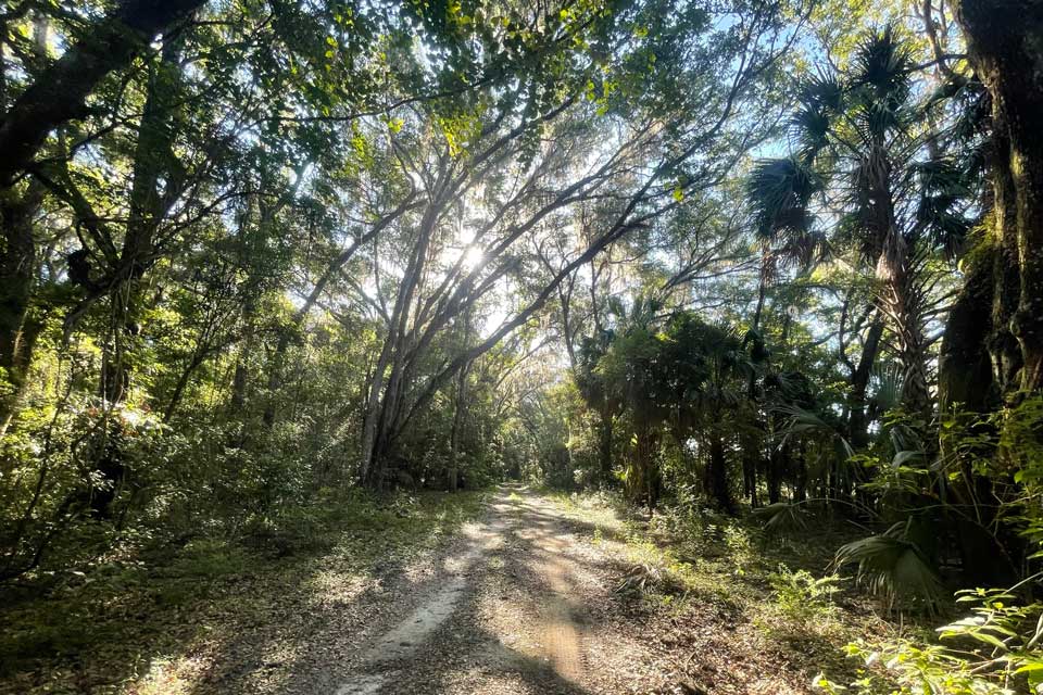
The multi-use trail is wide, flat, and well-maintained. On the other hand, the hiking trail, while narrow, is very well blazed with FL trail orange markers. You also get a bit of a workout because you will ascend and descend the rim of a ravine twice each way. This is nice since hills are unusual in Florida. In fact, you will find rock jutting from the earth. Unlike the multi-use trail, the hiking segments provide plenty of shade. I went during a dry spell and therefore encountered few biting insects. Seeing some pooled water here and there, and given the heavy woods, you can bet plenty of insects will come around in rainier times.
Yet, you’ll find plenty of opportunities to jump back on the multi-use trail which is far more cleared. Plus, even on a weekend, I found the trails very lightly used. And while there is no dramatic destination, you can spot woodland creatures such as deer one moment and find a open marshland view the next.
This is truly one of my favorite hikes in Marion county.
Trail Images Below
![]()

Cultivation Equipment at Pruitt Memorial
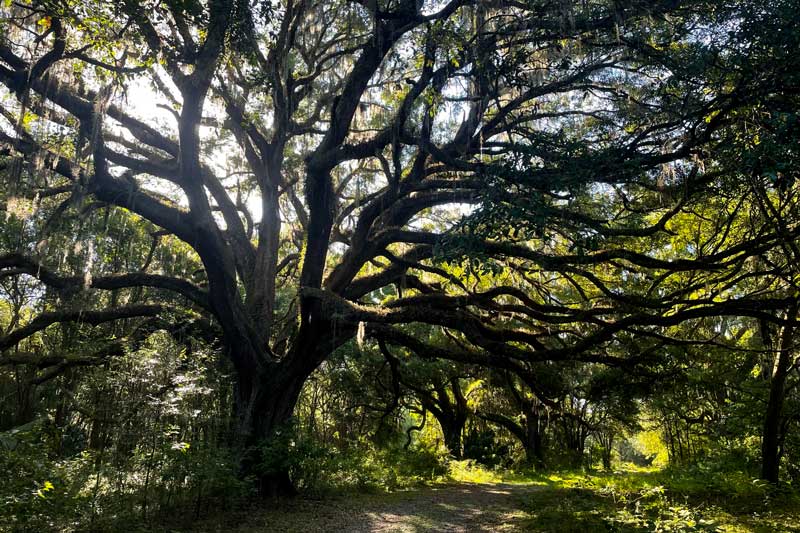
Live Oak on Pruitt Trail

Hiking Only Trail at Pruitt

Horace’s Duskywing
![]()